Additionally, each topic page is available as a PDF.
The Land of Israel
“Next year in Jerusalem.”
The closing words of the Passover Seder, spoken for centuries by Jews who had never seen the city.
Why this Topic exists
Why this land.
On a map of the ancient world, the land of Israel is easy to miss. It is small, a few days’ walk from end to end, wedged between the Mediterranean and the desert. Yet for more than three thousand years an entire civilization has kept its bearings by this narrow strip of land. Jews have prayed toward it, set their calendar by its harvests, and ended their holidays with the words “next year in Jerusalem,” from every corner of the earth. The question this Topic asks is: Why this land?
The answer begins with the land itself: where it sits, what it grows, who fought over it, and what each ruler left behind. The story of who remained on the land through every conquest belongs to the next Topic. This Topic is about the place itself, and about how a small country between sea and desert became, and stayed, the center of Jewish life. And it reads the land the way historians read any place, through geography, archaeology, ancient texts, maps, inscriptions, and objects together, because no single source can explain a place on its own.
Why here
The bridge between two worlds.
Open almost any world history textbook and you will find the Fertile Crescent: the arc of good farmland that curves from the Persian Gulf up through Mesopotamia, the country of the Tigris and Euphrates, and back down the coast to Egypt and the Nile. Two of the ancient world’s great civilizations grew up at its two ends, Mesopotamia in the east and Egypt in the west, and both of them get their chapters. The narrow strip of land that joins them tends to get a sentence. That strip is the subject of this Topic.
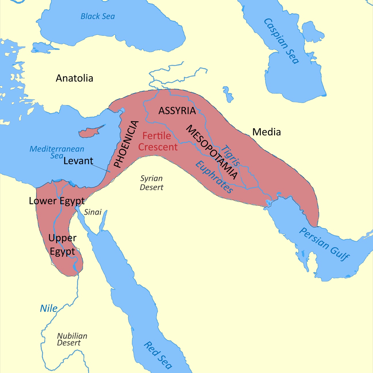
Its position is the whole story. This was the only land route between Egypt and Mesopotamia, so anyone moving between the two great powers, an army on the march, a caravan of traders, a royal messenger, had to pass through it. The main road, the Via Maris (Latin for “way of the sea”), ran up the coast, and a second, the King’s Highway, ran inland through the hills east of the Jordan River. Whoever controlled this land controlled the principal land route between two worlds, which is why it was conquered again and again. A country small enough to cross in a few days became central to three thousand years of history because it occupied the one corridor every empire eventually crossed.
On the roads, and off them
The roads that went around it.
Here the map plays a trick. The two great roads made the region a prize, but neither ran through the middle of it. The Via Maris kept to the coastal plain, and the King’s Highway to the high tableland east of the Jordan. Both skirted the central hills, the rocky spine where Jerusalem, Samaria, and the towns of Judah actually sat. The cities that grew rich on the passing traffic, Megiddo, Hazor, Gezer, and the Philistine ports, stood on the roads. Jerusalem did not.
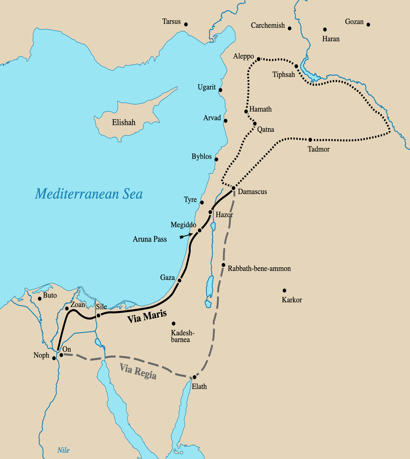
That is part of why a distinct people could take root in the hills and hold on. The high country was harder to reach and less worth fighting for than the highways below it. Empires wanted the roads; the hills were a poorer prize, off to one side. The land was strategic enough to draw one conqueror after another, while the Jewish heartland grew up in the one stretch the armies and the caravans mostly passed by.
The hills paid for that quiet by feeding themselves. Grain, wine, and olive oil, with sheep and goats on the slopes, made a country that did not need to buy its dinner. What it could not grow, it traded for: metal, and timber tall and straight enough to build with. The clearest case is the Temple itself. To raise it, Solomon sent wheat, olive oil, and wine north to the king of Tyre and took cedar and cypress in return (1 Kings 5). Even the greatest building project on the land ran on an exchange, its own food for the materials it lacked.
The land also produced goods worth exporting. Olive oil and wine were the everyday exports, carried in stamped jars, and the largest oil works known from the ancient world stood at Ekron, on the coastal plain. A few local products were treasures. The rarest was balsam, a perfume pressed from a shrub grown only in the oases of Jericho and Ein Gedi, the most expensive scent in the Roman world. Dates came from the same oases, and in later centuries the wine of Gaza traveled across the Mediterranean. One important qualification: the biggest profits from the trade, the tolls on the caravans and the great oil works, usually went to whoever held the land at the time, not to the people farming it.
Put together, that is a particular kind of homeland: rich enough to feed itself, and set just off the highways the empires fought to control. The geography did not only make the land a prize. It shaped who could settle it, and how.
A misconception this Topic addresses
The land’s ancient past is flattened into a few myths. The dedicated Misconceptions entry lays out the record.
- “There is no archaeological evidence for the First Temple.” see the dedicated entry →
The Land itself
One land, many names.
The land in question is the territory roughly bounded by the Mediterranean on the west, the Jordan River and the Dead Sea on the east, the Negev on the south, and the foothills of Lebanon on the north, about 10,000 to 11,000 square miles.
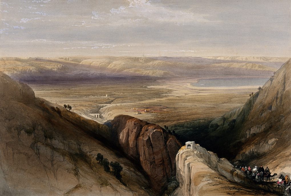
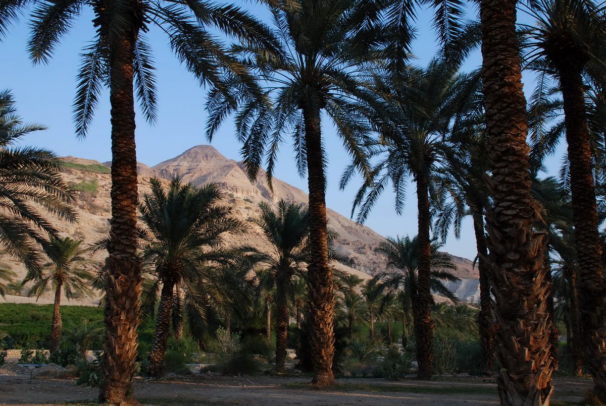
For so small a territory, the terrain is unusually varied. A fertile coastal plain runs along the Mediterranean. Behind it rise the central highlands, the limestone hill country of Judea and Samaria where Jerusalem, Hebron, and the early Israelite villages sit. East of the hills the ground drops into the Jordan Rift Valley, part of the Great Rift that runs down into Africa. The valley holds the Sea of Galilee in the north and, at its lowest point, the Dead Sea, the lowest exposed land on earth, more than 400 meters below sea level. The Galilee in the north is green and well-watered, and the Negev in the south is desert. These zones sit within a day's travel of one another, and the difference between them shaped where people settled in every era the rest of this Topic covers.
These lines describe a region, not a country with fixed borders. The land’s extent was drawn differently in different eras. Its core, in the phrase the Bible uses, ran from Dan in the north to Beersheba in the south, the length of the settled highlands. Under the united monarchy of David and Solomon it was one kingdom over the whole land. After Solomon it split into two smaller states, Israel in the north and Judah in the south. Centuries later the Hasmoneans built a large independent kingdom again. The three maps below show those moments. Some of the Israelite tribes had settled east of the Jordan River, on ground that today is the country of Jordan.
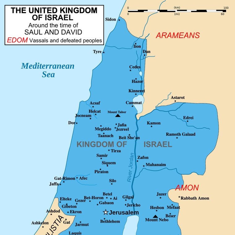 One kingdomDavid & Solomon, c. 1000 BCE
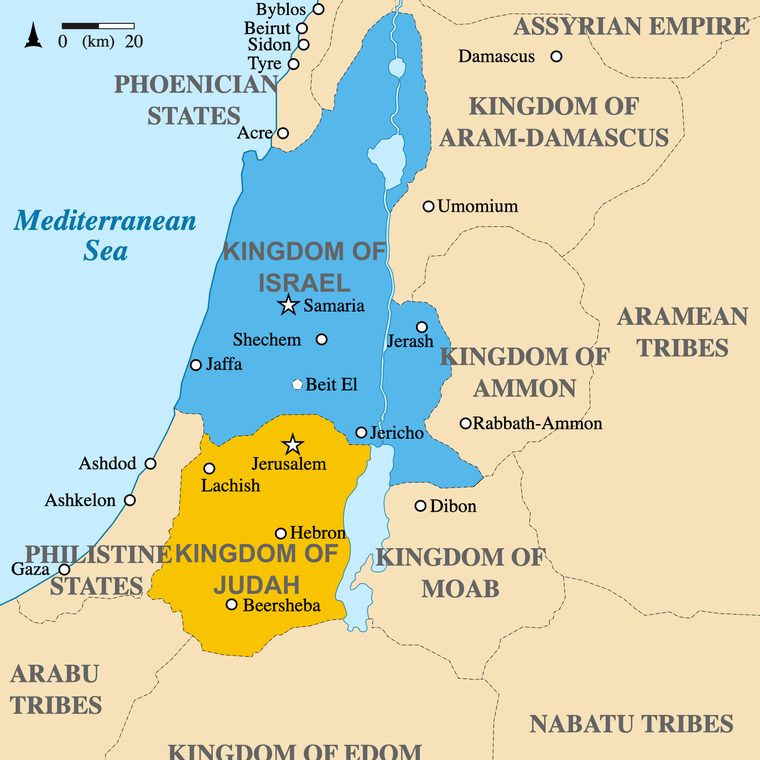 Two kingdomsIsrael and Judah, c. 830 BCE
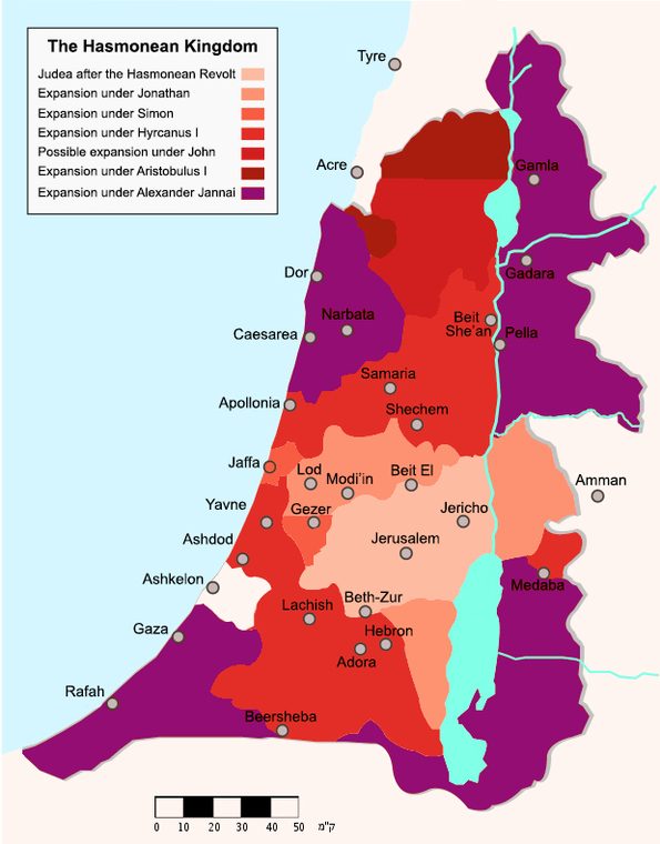 Independent againthe Hasmoneans, c. 100 BCE
The historical land of Israel is also not the same shape as the modern state of Israel, whose borders were drawn in the twentieth century. Several of the oldest and most important sites fall outside or on the edge of those modern lines. Hebron, with the tomb traditionally held to be the burial place of the patriarchs (Abraham, Isaac, and Jacob), together with Shechem, Beit El, and Shiloh from the earliest Israelite settlement, all lie in the area known today as the West Bank. The Temple Mount, in the Old City of Jerusalem, is in East Jerusalem. Mount Nebo, where the Bible places Moses looking out over the land he would not enter, is east of the Jordan River, in the modern country of Jordan. Where those modern lines fall is a matter of present-day politics, taken up in Unit 2. The historical geography is older than any of them.
The land has carried several names across recorded history:
Canaan is the earliest name attested, appearing in Egyptian inscriptions from the second millennium BCE. It denoted the region west of the Jordan, inhabited by a mosaic of Bronze Age peoples (Canaanites, Phoenicians, Philistines, Jebusites, and others) speaking related Northwest Semitic languages.
Israel first appears as a name on the Merneptah Stele, an Egyptian inscription dated to about 1208 BCE, which names "Israel" as a people defeated in Canaan. It is the oldest known reference to Israel outside the Hebrew Bible. From roughly the eleventh century BCE, "Israel" named the United Monarchy under Saul, David, and Solomon, then the Northern Kingdom after the split, and after the Babylonian exile, the people more than any state.
Judah (Hebrew Yehudah) was the southern kingdom after the split around 930 BCE, centered on Jerusalem. Its Greek and Latin forms (Ioudaia, Iudaea) became the Roman name for the province after Pompey's conquest in 63 BCE.
Palestine (Latin Palaestina) is the name the Roman emperor Hadrian imposed on the province after crushing the last great Jewish revolt (the Bar Kokhba Revolt) in 135 CE. Drawn from "Philistia," the coastal region of the long-vanished Philistines, the choice was a deliberate move to cut the Jewish tie to the land. It remained the Roman and Byzantine name, and survived under early Islamic rule as Jund Filastin, one district of Greater Syria. The Crusaders replaced it with the Kingdom of Jerusalem. The Mamluks and Ottomans did not use it at all, governing the land instead as part of the Damascus and Beirut provinces and the district of Jerusalem. Britain revived the name in 1917.
These are the best-known of the land's names. All of them point to the same land, and not one is its true name. Each was the label used by whoever governed, and it changed when the government did. The table below traces the fuller sequence, period by period.
A name on a map records who was in charge, not who was there.
| Era or ruler | Dates | What the land was called |
|---|---|---|
| Bronze Age (Egyptian records) | c. 1400–1200 BCEabout 200 years | Canaan |
| Israelite kingdoms | c. 1000–586 BCEabout 400 years | Israel, with Judah in the south |
| Persian Empire | 539–332 BCEabout 200 years | Yehud |
| Greeks, then Romans | 332 BCE–135 CEabout 460 years | Judaea (Greek Ioudaia, Latin Iudaea) |
| Rome and Byzantium | 135–638 CEabout 500 years | Syria Palaestina, later Palaestina Prima, Secunda, and Tertia |
| Early Islamic rule | 638–1099about 460 years | Jund Filastin, a district of Greater Syria |
| Crusaders | 1099–1291about 190 years | The Kingdom of Jerusalem |
| Mamluks | 1291–1517about 225 years | Part of Greater Syria, no separate name |
| Ottomans | 1517–1917400 years | Districts of the Damascus and Beirut provinces and the Sanjak of Jerusalem |
| British Mandate | 1917–194831 years | Palestine |
| State of Israel | 1948 to todayover 75 years | Israel |
Ancient Israel · c. 1500 – 586 BCE
Hilltop villages, kingdoms, exile.
The earliest archaeological trace of distinct Israelite settlement in the hill country of Canaan dates to roughly the late thirteenth century BCE: small hilltop villages with characteristic four-room houses and an absence of pig bones that sets them apart from neighboring Canaanite and Philistine sites. The biblical narrative compresses what was in fact a longer, more gradual emergence.
By about 1000 BCE the United Monarchy under David and Solomon centered the polity on Jerusalem, and Solomon's First Temple was built around 957 BCE. Around 930 BCE, after Solomon's death, the kingdom split into the Northern Kingdom of Israel (capital Samaria) and the Southern Kingdom of Judah (capital Jerusalem). Assyria, the dominant empire of the age, based in Mesopotamia, destroyed the Northern Kingdom in 722 BCE and dispersed its population, the "ten lost tribes" of later tradition. Judah held on until 586 BCE, when Nebuchadnezzar II of Babylon besieged Jerusalem, destroyed the First Temple, and exiled much of the population to Babylonia.
One moment in that long Assyrian threat left a record so detailed we can still see it. In 701 BCE the Assyrian king Sennacherib marched against Judah and besieged its fortified cities. He carved the campaign onto the walls of his palace at Nineveh (in what is now Iraq) in a series of stone panels showing the attack on Lachish, a major Judahite city. The same event is described in the Bible, in 2 Kings 18.
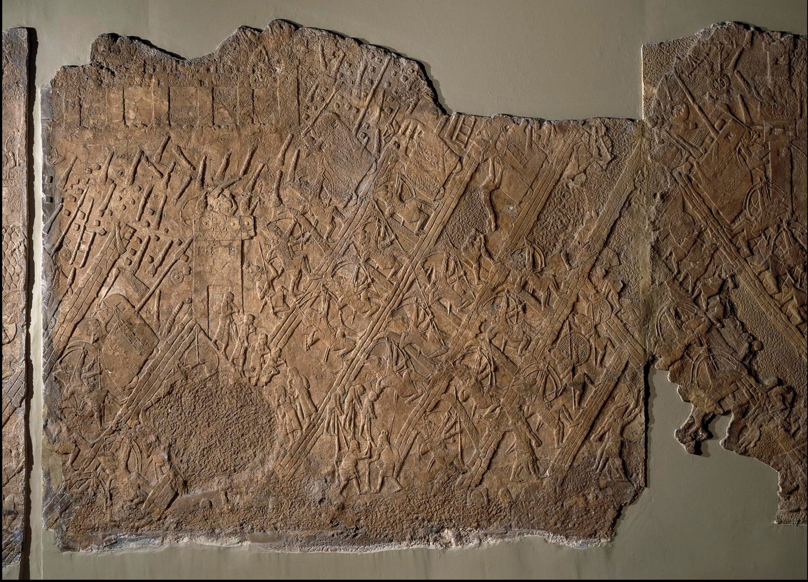
The Assyrians also wrote the campaign down. On a six-sided clay prism (the Taylor Prism, named for the man who acquired it, now in the British Museum), Sennacherib's scribes recorded his own account in cuneiform, the wedge-shaped writing of ancient Mesopotamia. He boasts of capturing forty-six of Hezekiah's walled towns and of trapping Hezekiah, the king of Judah, "like a caged bird" inside Jerusalem, his royal city.
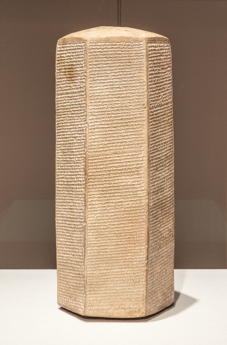
One detail stands out. Sennacherib lists every Judahite city he claims to have taken, but he never says he took Jerusalem. The boast stops at the walls. He surrounds the king and then, on his own triumphal monument, falls silent about the prize. The Bible (2 Kings 19, Isaiah 37) says Jerusalem was spared when the Assyrian army withdrew. The enemy's own record, written to celebrate his victories, quietly confirms the one fact it had no reason to admit: the capital did not fall. These objects can be seen in the museum's Antiquity gallery.
The Babylonian Exile and Return · 586 – 538 BCE
Forty-eight years. One generation.
The exile lasted about forty-eight years, a single human generation. In 539 BCE Cyrus the Great of Persia conquered Babylonia, and the next year issued the edict permitting the exiled Judeans to return and rebuild the Temple. Not all went back. A large part of the community stayed in Babylonia and built one of the most influential centers of the Jewish diaspora, the communities living outside the land, a center that lasted 2,500 years. Those who returned, under Zerubbabel, Ezra, and Nehemiah, rebuilt the Temple by about 516 BCE. This begins the Second Temple period.
The Second Temple Period · 538 BCE – 70 CE
Six centuries, four ruling powers.
The Second Temple period runs nearly six centuries and four successive ruling powers, with Jewish life and self-governance continuing under each.
Under the Persian Empire (538–332 BCE), the returned community organized itself around the rebuilt Temple, with authority shared between the High Priest and the imperial governor. Much of the canon of the Hebrew Bible took shape in this period. The province had its own name in the imperial system, Yehud, and by the fourth century BCE it was striking small silver coins stamped YHD in the old Hebrew script, among the earliest coins Jews ever minted.
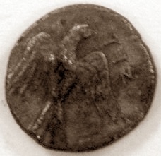
In the Hellenistic period (332–63 BCE), Alexander the Great took the region in 332 BCE; after his death it passed between Ptolemaic Egypt and the Seleucid Empire of Syria. When the Seleucid king Antiochus IV moved to suppress Jewish practice in 167 BCE, the Maccabean revolt followed. The Maccabees (Hasmoneans) established an independent Jewish kingdom that ruled from 140 to 63 BCE, the only sovereign Jewish polity between the Babylonian exile and 1948. Hanukkah commemorates this revolt. The Hasmonean rulers struck their own coins, starting with Yehohanan (John Hyrcanus) around 132 BCE, inscribed in Paleo-Hebrew, "Yehohanan the High Priest and the Council of the Jews," and carrying no human or divine image, only the plants of the land.
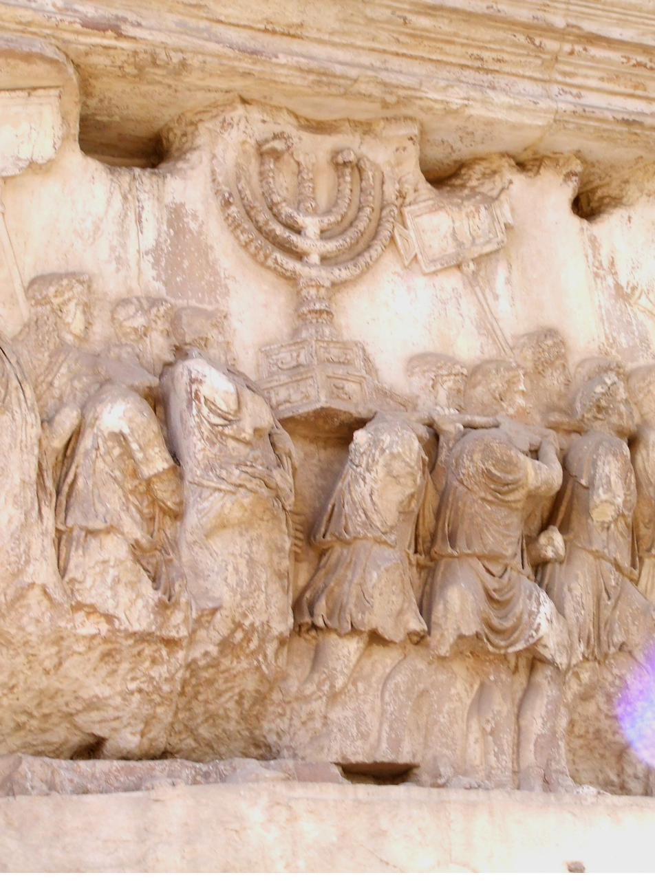
Under Rome (63 BCE – 70 CE), Pompey took Jerusalem in 63 BCE. The region was administered as a client kingdom under Herod the Great (37–4 BCE), who rebuilt the Temple complex on the scale described in the Temples Topic. After Herod, Rome ruled more directly, with frequent unrest. A major Jewish revolt began in 66 CE; in 70 CE the legions of Titus besieged Jerusalem, breached the walls, and destroyed the Second Temple. Through the four years of that revolt the rebels struck their own silver shekels, in the same archaic Hebrew script, reading "Jerusalem the Holy" and "For the Freedom of Zion." Rome carved the triumph onto the Arch of Titus, which still stands on the Via Sacra, the Temple's menorah carried in procession cut into its relief.
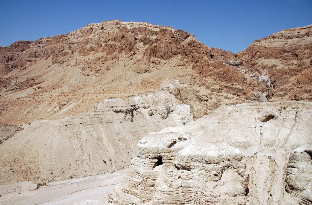
The physical record of this period is unusually rich. In caves above the Dead Sea at Qumran, between 1947 and 1956, roughly nine hundred manuscripts were recovered: the Dead Sea Scrolls, copied between the third century BCE and the first century CE. They include the oldest surviving copies of books of the Hebrew Bible, written and stored by a Jewish community living in the land during the Second Temple period; most are now held in the Shrine of the Book at the Israel Museum.
 Yehud4th c. BCE
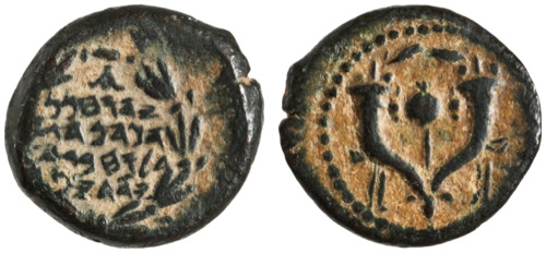 Hasmoneanfrom c. 130 BCE
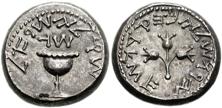 First Revolt66–70 CE
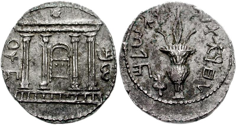 Bar Kokhba132 CE
What’s in a name
How the name changed.
“Palestine” has carried different meanings under different rulers. Rome imposed it as a punishment. Its most misunderstood chapter is the British Mandate: from 1917 to 1948 the name was the administrative label for a territory that included the Jewish national home. Palestine was the name of a place, and Palestinian was the word for the people who lived there. The 1925 citizenship order set no test of race or religion: a Jew, a Christian, and a Muslim who lived in Palestine were all Palestinian citizens, and about 800,000 people held that citizenship until it ended in 1948.
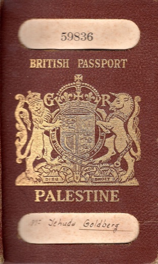
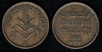
The territory also carried Hebrew openly. The Mandate’s money, the Palestine pound, was printed in English, Arabic, and Hebrew, and the Hebrew carried the letters א״י, short for Eretz Yisrael, the land of Israel. Government passports read the same. A Jewish resident of Haifa carried a Palestinian passport. The football team that represented Palestine, a member of FIFA from 1929, was almost entirely Jewish and used the blue-and-white flag bearing the Star of David. The Palestine Post (later the Jerusalem Post), the Palestine Symphony (later the Israel Philharmonic), and the Anglo-Palestine Bank (later Bank Leumi) were Jewish institutions. A distinct Palestinian Arab national identity took shape over the twentieth century, and after 1948 that became the word’s primary meaning.
Israel today is the nation-state of that people, and a democracy whose citizens, of every faith, are Israeli. What kind of state it is, and the communities within it, are taken up in Unit 2.
The land's marks
What each power built.
Every ruling power left its mark on the land. Some left monuments, others roads, cities, walls, or fields, and together they shaped the landscape you can still walk through today. Here is a short record, from the First Temple to the desalination plants.
| Era or ruler | Dates | What they built or changed |
|---|---|---|
| Israelite kingdoms | c. 1000–586 BCEabout 400 years | Jerusalem as capital; Solomon's First Temple, c. 957 BCEOn the landterraced hillsides, cisterns, and rock-cut presses for wine and oil |
| Babylon | 586–539 BCEabout 50 years | The First Temple destroyed and much of the people exiledOn the landthe poorest left behind to work the vineyards and fields |
| Persia | 539–332 BCEabout 200 years | The return permitted and the Second Temple rebuilt, c. 516 BCEOn the landthe land reorganized as the farming province of Yehud |
| Rome | 63 BCE–324 CEabout 390 years | Herod's Temple Mount, Caesarea's harbor, Masada, aqueducts, and roads; the Second Temple destroyed in 70 CEOn the landdate and balsam groves at Jericho |
| Byzantium | 324–638 CEabout 310 years | Churches and pilgrimage sites, among them the Church of the Holy SepulchreOn the landdesert farms and vineyards in the Negev, their wine shipped across the empire |
| Early Islamic rule | 638–1099about 460 years | The Dome of the Rock (691) and al-Aqsa Mosque on the Temple Mount; the new town of RamlaOn the landnew crops and irrigation, among them sugarcane and citrus |
| Crusaders | 1099–1291about 190 years | Castles, churches, and the fortifications of Jerusalem and AcreOn the landsugar mills and cane fields in the Jordan valley |
| Mamluks | 1291–1517about 225 years | Rebuilding in Jerusalem and Hebron: schools, fountains, markets, bridges, and roadside innsOn the landsugar refineries |
| Ottomans | 1517–1917400 years | Suleiman's rebuilt walls of Jerusalem, 1537–41, still standing today; roadside fountains and inns; a rail branch to Haifa in 1905On the landthe first modern farming colonies begun in the 1870s and 1880s |
| British Mandate | 1917–194831 years | The deep-water port of Haifa, roads, and railOn the landdrained marshland and the Jaffa-orange export trade |
| State of Israel | 1948 to todayover 75 years | The National Water Carrier and seawater desalinationOn the landdrained swamps, planted forests, and drip irrigation |
How we know. Most of what this table records can still be seen or has been excavated: Herod's Temple Mount and the Western Wall, Caesarea's harbor, Masada, the Dome of the Rock, Suleiman's walls. The earliest lines lean more on written sources. Solomon's First Temple is described in detail in the Hebrew Bible, yet no trace of it has been dug up, because the Temple Mount where it stood has never been excavated. Its destruction by Babylon in 586 BCE is a different case, and it shows up in the ground as a layer of burnt houses and arrowheads in the City of David. Which claims rest on text and which on stone is itself part of the record.
The land in daily life
The land is built into the religion.
You do not have to live on the land for it to shape your life. For most of Jewish history most Jews lived somewhere else, and the land still ran through nearly everything they did.
Begin with the direction of prayer. Three times a day, traditional Jewish worship turns toward Jerusalem. A synagogue in New York, Marrakesh, or Mumbai is built so the congregation faces the same hill, thousands of miles away.
The calendar keeps the seasons of this one land. Passover falls at the spring barley harvest, Shavuot at the wheat, Sukkot at the fall ingathering. Jews in the Southern Hemisphere still keep the spring festival in their own autumn, because the calendar belongs to the land, not to the local weather.
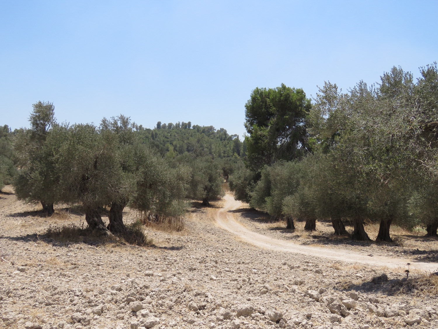
Even the crops are the land’s own. Deuteronomy praises it as a land of seven: wheat, barley, grapes, figs, pomegranates, olives, and dates. These are the plants a farmer in the hills could actually raise, and they run straight through Jewish life. Wheat and barley fix the dates of the spring festivals. Grapes and olives gave the wine and the oil of the table and the synagogue lamp. The fig and the pomegranate turn up again and again in the carved and painted floors of ancient synagogues. To know the land is partly to know what grew on it.
The oldest description of all, in the Book of Exodus, calls it a land flowing with milk and honey. The milk is the herder’s, from the goats and sheep on the hills. The honey, in the old sense, is not the bee’s but the thick dark syrup boiled down from dates, one of the same seven. It is still made and sold across Israel today, under the old name silan. It is a picture of a land that could both graze and grow.
 Dates
Dates
 Pomegranates
 Olives
A whole body of Jewish law applies only on the land: the sabbatical year when the fields rest, the tithing of crops, the rules of the harvest. For centuries these laws were studied in detail by people who owned no field there, which kept the land present in the law even in its absence.
And the longing is written into the happiest moments. Three of the year’s festivals once sent people up to the Temple in Jerusalem. Long after the Temple was gone, the pull stayed in the words. The Passover meal ends on “next year in Jerusalem,” and a wedding, at its high point, stops to remember the ruined city.
This is what sets the land apart from an ordinary homeland. It is not only where a people came from. It is stitched into how they pray, what they eat, when they celebrate, and what they hope for. That is why a small country has stayed at the center of a civilization for three thousand years, even when most Jews lived far from it.
The land itself, after 1948
Draining, planting, and watering the ground.
The land itself has changed too, and never faster than in the last hundred years. Settlers drained the malarial marshes of the Jezreel Valley in the 1920s, and the young state drained the Hula wetlands in the 1950s, turning swamp into farmland. The kibbutz, a collective farm first built at Degania beside the Sea of Galilee in 1910, became the model for settling and working the land in common. Forests went up where the hills had been bare for centuries. Israel is among the few countries that entered the twenty-first century with more trees than it had a hundred years before.
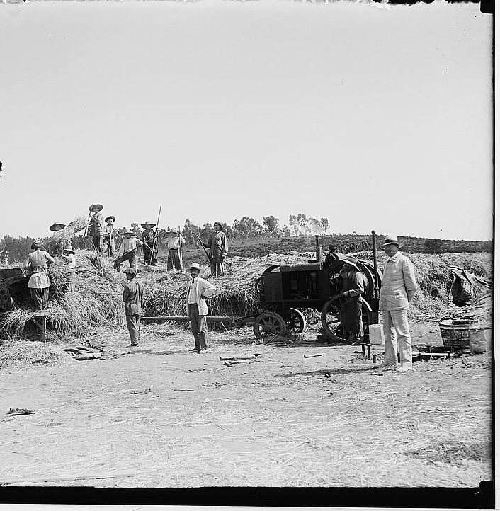
Water was the harder problem, because most of the country is dry. In 1964 the National Water Carrier began moving water from the Sea of Galilee in the north down to the center and the arid south, tying the whole country's supply into one system. The next year an Israeli engineer, Simcha Blass, founded Netafim and sold the first modern drip irrigation, feeding water drop by drop to the root instead of flooding the field. It now waters most of Israel's crops and is used around the world. From 1999 the country built large seawater desalination plants along the Mediterranean coast, at Ashkelon, Hadera, and Sorek, the last among the biggest in the world. A land that began with too little water now makes much of its own.
None of this settles a political question. It is part of what happened to the land itself.
Object Spotlight
The Merneptah Stele, Egypt, c. 1207 BCE.
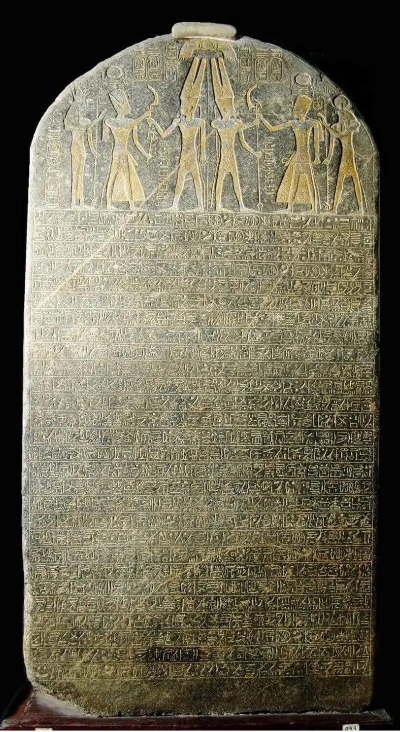
Stand in front of it and the size hits you first: a slab of dark granite taller than a person, more than three meters high, its top rounded like a tombstone. Up at the top, a carved picture shows a king facing a god, with a winged sun-disk spread above them. Below that, packed edge to edge, are twenty-eight lines of hieroglyphs, Egyptian picture-writing. It is heavy, official, and meant to impress.
It is a victory stele, an Egyptian monument of boasting. A stele is just a tall standing stone set up to carry a message. A victory stele records a king's triumphs for the gods and for everyone who passes it. This one was carved for the pharaoh Merneptah around 1207 BCE (on the back of an older king's slab, to save stone) and set up in his temple at Thebes, where the archaeologist Flinders Petrie dug it up in 1896.
Here is why this Egyptian war-monument opens a Topic about the land of Israel. Down in the second-to-last line (line 27), among a list of peoples the pharaoh claims to have crushed, written with the specific Egyptian sign that means "a people" rather than "a place," is the name Israel. This is the oldest mention of Israel found anywhere outside the Bible: the first time the name shows up in the written record of the ancient world. And it shows up not in a friendly source, but on the monument of an enemy bragging about beating them.
Look closer at the tension in that, because it is the whole point. A king bragging on a monument is not a neutral witness. Egyptian victory texts routinely exaggerated, turning stalemates into triumphs, and Merneptah's claim to have wiped Israel out is almost certainly overstated. But that cuts the right way for a historian: a pharaoh inflating a victory still had to be boasting about a people his audience would recognize. The other names beside Israel (Ashkelon, Gezer, Yanoam) were real places of the time. The boast only works if the people were really there.
The stele still stands in the Egyptian Museum in Cairo. The monument carved to celebrate wiping Israel out became, instead, the oldest independent witness that the people were there at all, and historians still return to it as one of the starting points for the history of ancient Israel.
Key takeaways
- The land is small and unusually varied: a coastal plain, the central highlands, the Jordan rift, the green Galilee, and the Negev desert, all within a day’s travel. Its position on the bridge between Egypt and Mesopotamia made it both a crossroads and a prize.
- It has carried several names, Canaan, Israel, Judah, Palaestina, each chosen by whoever ruled at the time. A name on a map records who was in charge, not who was there.
- Every ruling power left physical marks on the land, from Solomon’s Temple and Herod’s stonework to the Dome of the Rock, Suleiman’s walls, and the water systems of the modern state.
- The land itself has changed, never faster than in the last hundred years: drained marshes, planted forests, the National Water Carrier, and seawater desalination.
- The land is built into Jewish life far beyond its borders: the direction of prayer, the seasons of the calendar, a body of law tied to its soil, and the closing hope of “next year in Jerusalem.”
Discussion questions
Working from the evidence.
Written as open inquiry. There is no single expected answer.
- What’s in a name? (C3 D2.His.5). This land has been called Canaan, Israel, Judah, and Palestine, each by the power that ruled it. Under Rome the name Palestine was used to break the Jewish tie to the land. Under the British Mandate the same name was printed in Hebrew on the country’s money. Trace how the meaning of a place-name shifts with its rulers. Why do such names carry political weight today?
- Weighing the kinds of evidence (C3 D3.1). This Topic builds its case from many kinds of evidence: geography and maps, archaeology, monuments like the Merneptah Stele and the Arch of Titus, the coins struck by Jewish rulers, and written records. Which kind do you find most persuasive, and why? What can each kind show that the others cannot?
- Limits of evidence (C3 D2.His.10). The Merneptah Stele was made to boast, and it probably exaggerates. How should a historian weigh a source that is biased (even partly false) but very old? When can a hostile source still be useful?
- Why here? (C3 D2.Geo.2). The land sits between the Mediterranean and the desert, on the crossroads between Egypt and Mesopotamia. How did its geography, its size, position, water, and terrain, both make it valuable to every passing empire and shape where people could actually live on it?
- A place at the center (C3 D2.His.14). Jewish prayer faces Jerusalem, the calendar keeps the land’s harvest seasons, and holidays end on “next year in Jerusalem,” even for communities that lived far away. How can a place stay at the center of a culture for people who have never set foot on it?
- Reading the marks on the land (C3 D2.His.16). Every ruling power left its mark on the land, from Herod’s stonework to Suleiman’s walls to modern water systems. What can the physical marks a power leaves behind tell you about it, and what can they not tell you?
Classroom Connections
Where this Topic fits.
Teaching Connections
The disciplines and courses this Topic naturally supports, for any educator, anywhere.
- Geography: how a land’s location, terrain, and water shape its history.
- Ancient & World History: Canaan, the Israelite kingdoms, Jerusalem, and the First Temple, beside Mesopotamia and Egypt.
- World Religions: how the land is woven into Jewish prayer, the calendar, law, and pilgrimage.
- Archaeology: reading the material record of a place, from the Merneptah Stele to the marks each ruler left.
- Environmental & Modern History: the land’s physical transformation, its drainage, water, and desalination.
- Historical Thinking: reading names, monuments, and physical remains as evidence.
What students practice
Students learn to tell the kinds of evidence apart, archaeological finds, written sources, historical geography, and later interpretation, and to build a historical argument from them rather than lean on any single source.
Standards Alignment
- NYS Global History & Geography: 9.1 (the ancient world), 9.2 (Belief Systems), and 9.3 (the classical and Roman world).
- Common Core ELA-Literacy: RH.6–8.7 and RH.9–10.7 (integrating visual and textual information): maps, archaeological images, and primary texts read alongside the geography.
- C3 Framework: Dimension 2 (continuity and change, perspectives, the limits of evidence) and Dimension 3 (developing claims and using evidence).
Sources and citations
- Flavius Josephus. The Jewish War and Jewish Antiquities. 1st century CE. Primary source for the Second Temple period and the Roman destruction.
- The Hebrew Bible (Tanakh). Primary source for several passages read here as history: Deuteronomy 8 (the seven species of the land), Exodus 3 (“a land flowing with milk and honey”), and 1 Kings 5 (Solomon’s timber trade with Hiram of Tyre).
- Ben-Sasson, H. H., ed. A History of the Jewish People. Cambridge, MA: Harvard University Press, 1985.
- Schiffman, Lawrence H. Reclaiming the Dead Sea Scrolls. Philadelphia: Jewish Publication Society, 1994. On the Hasmonean period and the Second Temple. Excerpt via the Center for Online Judaic Studies (cojs.org).
- Stiebing, William H., Jr., and Susan N. Helft. Ancient Near Eastern History and Culture. 3rd ed. New York: Routledge, 2017.
- Sachar, Howard M. A History of Israel: From the Rise of Zionism to Our Time. New York: Alfred A. Knopf, 2007.
- Aharoni, Yohanan. The Land of the Bible: A Historical Geography. Rev. ed. Translated by A. F. Rainey. Philadelphia: Westminster Press, 1979. (The standard historical geography of the land: its regions, borders, names, and roads.)
- Rainey, Anson F., and R. Steven Notley. The Sacred Bridge: Carta’s Atlas of the Biblical World. Jerusalem: Carta, 2006. (The land as a corridor: the Via Maris, the King’s Highway, and the trade routes of the ancient Near East.)
- Borowski, Oded. Agriculture in Iron Age Israel. Winona Lake, IN: Eisenbrauns, 1987. (The crops, terraces, and farming of the hill country, including the seven species.)
- The Merneptah Stele, c. 1208 BCE. Egyptian Museum, Cairo. (Primary source; earliest known reference to "Israel" outside the Hebrew Bible.)
- The Lachish Reliefs, c. 700–681 BCE. The British Museum, London. (Primary source; the Assyrian palace carvings of Sennacherib's siege of the Judahite city of Lachish in 701 BCE.)
- The Taylor Prism (the Sennacherib Prism), 691 BCE. The British Museum, London. (Primary source; Sennacherib's own annals, recording the campaign against Hezekiah of Judah. Two further complete copies exist: the ISAC Prism, Institute for the Study of Ancient Cultures, University of Chicago, and the Jerusalem Prism, The Israel Museum.) For a museum account of the episode, see the Metropolitan Museum of Art, "Sennacherib and Jerusalem" (Assyria to Iberia exhibition blog).
- Arch of Titus, Rome, c. 81 CE. (Primary source for the Temple objects carried in triumph in 70 CE.)
- Silver tetradrachm of the Bar Kokhba Revolt, 132 CE. Ashmolean Museum, University of Oxford. (Primary source.)
- Library of Congress, G. Eric and Edith Matson Photograph Collection (Palestine, 1898–1946).
- Israel Antiquities Authority: reports on the continuous material record from antiquity through the Ottoman period.
- Israel State Archives: the official archive of the State of Israel; Ottoman, British Mandate, and post-1948 government records.
- National Library of Israel: Ottoman-era land records, nineteenth-century Hebrew press, and rabbinic correspondence from the historic Yishuv.
- Yakuel, Orit. The Holocaust Needs a Continuation (Petition Two). The Makor Project, 2026. Sections 5.2 and 6.1–6.6 supply the spine of the demographic and continuous-presence argument.
The documented record of Jewish presence in the land after 70 CE, and how historians know it: the evidence, source by source.
Comments?
Write to editor@makorproject.org.
Last updated: June 2026.